

GNSS CORS Solutions
Showing the single result
- WHAT IS RTK BASE STATION?
- SATELLITE PERMANENT DIFFERENTIAL RTK BASE STATIONS
- REGIONAL NETWORKS OF SATELLITE DIFFERENTIAL RTK BASE STATIONS
WHAT IS RTK BASE STATION?
With the development of Global Navigation Satellite Systems (GNSS), various methods of satellite definitions using GNSS signals have appeared. In addition to the absolute method, widely used in navigation, relative methods are also used, which can significantly improve the accuracy of determining the location of objects on Earth, which is necessary in such areas as geodesy, topography, surveying, cadastre, geodynamics, monitoring of deformations of objects and structures.
The constant need to use relative satellite methods for determining the coordinates of objects in these areas of activity has led to the creation of permanent accurate positioning systems. Traditional satellite methods of relative definitions based on the principle of differential correction imply the use of at least two sets of GNSS equipment, one of which is a reference (basic, reference), and the other is movable (movable). The reference GNSS receiver is installed at a reference geodetic point or at a point that is considered to be the original one. A set of GNSS receiver installed permanently at the starting point (reference point), necessary for the formation of satellite correction information, is called a satellite differential station. A mobile receiver used to determine the location of points of interest is called a rover. When using relative satellite determination methods, the maximum permissible distance to the differential station is limited and it is determined by the characteristics of the satellite equipment at the station and on the rover, the methods and conditions for performing satellite measurements. If in the course of work it is required to determine the location of the points of objects located outside the working area of the differential station, then the station is moved closer to the object to another reference (starting) point. In territories where satellite definitions and on-site surveys are constantly performed, permanent satellite differential stations are installed and used instead of portable field differential stations. Several permanently installed differential stations form a network. The ground infrastructure being created on the basis of networks or single permanent differential stations, including satellite GNSS receivers, communications equipment, software, computer equipment, allows obtaining spatial coordinates with an accuracy of millimeters over vast areas. It is scalable, functionally complementary and more reliable than traditional satellite measurement and navigation tools.
When creating precision positioning systems, specially developed models of GNSS receivers and software are used to provide differential corrections from a single station or to create a network of differential stations and a regional accurate positioning service over vast areas. We also use the latest state-of-the-art means of communication and communication.
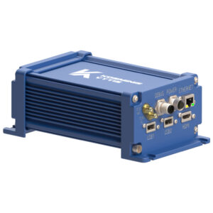
A differential geodetic station (RTK Base Station) is an electronic device located at a point on the earth’s surface with certain coordinates that receives and processes signals from satellite navigation systems and provides the transmission of information necessary to improve the accuracy of determining coordinates using satellite navigation systems.
A permanent satellite differential (reference, base, reference, geodetic) station is a satellite geodetic equipment installed permanently on a specially prepared place and having a coordinate description in the spatial coordinate system, constantly and continuously receiving and relaying GNSS signals. Satellite differential stations are remotely controlled by special software that generates differential corrections for RTK operation and post-processing data for transmission to consumers via various communication channels.
SATELLITE PERMANENT DIFFERENTIAL RTK BASE STATIONS
A permanent satellite differential station is a hardware and software complex designed to ensure the performance of measurements and determination of the spatial location of objects by providing information for correcting data obtained using GNSS receivers, including satellite, communication, computer and other equipment, specialized software installed in the area of work, installed on a permanent basis and functioning continuously.
A permanent differential station includes a GNSS receiver, satellite antenna, uninterruptible power supply, communications equipment, lightning protection systems and lightning rods that are installed permanently in a specially prepared place. The satellite antenna of the differential station is rigidly attached to the top of a special pylon mounted on a fixed base similar to the points of the geodetic base. The coordinates of the antenna are determined relative to geodetic points in the general earth coordinate system with the parameters of the transition to the local (local) coordinate system. Thus, the satellite differential station is the carrier of the coordinate system on the ground, like traditional geodetic reference points.
The differential rtk base station can be controlled automatically and controlled remotely from a personal computer (server) and specialized software. It can work autonomously, without the participation of an operator. The station can generate satellite data for subsequent processing with data from field satellite measurements, as well as satellite differential corrections for rtk rover users to obtain accurate spatial coordinates in real time. Data for post-processing can be archived on the hard disk of the computer of the differential station and transmitted via communication channels to an FTP server for remote access. Users of mobile receivers can receive differential corrections via radio channels, high-speed wireless networks (GSM, GPRS, CDMA, WiFi, etc.) or via the Internet.
Permanent satellite differential stations are installed in places with the most favorable conditions for receiving satellite signals and within the radius of their operation reliably provide corrective data to portable GNSS receivers of users 24 hours a day, 365 days a year. One differential station provides the determination of spatial coordinates in real time with centimeter accuracy within a radius of no more than 25-30 km. In principle, the distance of the RTK rover from the differential station can be large, for example 300 km. Several permanent satellite differential stations connected to a network can provide operation over a much larger area.
Advantages of a permanent differential station over a field satellite station:
- Continuous and continuous operation 365/24/7
- The best location of the differential rtk base station
- Constant reference coordinates
- Formation of RTK and DGPS satellite corrections with their transmission via radio, GSM or Internet channels
- Automatic creation of RINEX data for post-processing
- Satellite corrections for RTK and DGNSS
The composition of the system of a permanent station (network of stations) may be different depending on your needs. For example, there are three possible options for creating a positioning system based on a single differential station:
- The simplest version of a permanent single differential station with the ability to record data for post-processing with field rover data.
- A permanent differential station under the control of external software with the ability to record data for post-processing with field rtk rover data and the formation of RTK corrections.
- A network of constantly operating differential stations under general management and the formation of a diverse service.
To begin with, you can install one differential station in the simplest configuration to accumulate data for post-processing with field rover data. You will immediately begin to use all the advantages of a permanent station. In the future, you will be able to gradually invest in the development of a network of differential stations and an accurate positioning service, incrementally increasing functions in accordance with the growth of your needs.
REGIONAL NETWORKS OF SATELLITE DIFFERENTIAL RTK BASE STATIONS
A network of differential stations is a set of constantly operating satellite differential stations installed on the ground according to a certain scheme, the relative position of which is determined in a single coordinate system, united by communication channels for collecting and processing satellite data in a single center, so as to ensure the measurement and determination of the spatial location of objects over a vast area with the same accuracy and in a single the reference frame of time and space.
The network of permanent satellite differential stations has advantages in comparison with single base stations in that it has a large coverage area and provides uniform and high accuracy due to the possibility of constructing a local error model that includes delays of GNSS signals in the ionosphere and troposphere and the formation of network differential corrections for the coverage area.
One differential station provides the determination of spatial coordinates in real time with centimeter accuracy within a radius of no more than 25-30 km. In principle, the distance of the rtk rover from the differential station can be large, for example 300 km. However, when moving away from the gps station, the positioning accuracy deteriorates in proportion to the distance. A network of differential stations can cover a large area, the more stations, the larger the coverage area. To eliminate the problem of obtaining accurate and reliable results at a distance, the stations are installed tightly with overlaps of working areas.
In order to exclude errors introduced by distortions in the atmosphere, as well as the increasing error from the distance from the nearest station, a real-time model of errors and corrective corrections is created based on data from several stations and knowledge of their exact position. Such a model implies the joint equalization of data from all stations and the calculation of the field of differential corrections for the entire network coverage area. Thanks to the network method of generating differential corrections, the user can reliably obtain coordinates at distances from the station up to 50 km, and the distance between stations can be up to 80 km. At the same time, the same accuracy is ensured over the entire coverage area.
It is more efficient to control the operation of several differential stations located on a vast territory from a single control center. Thus, this structure is a network of differential stations, uniformly managed to create a single field of corrective corrections for all users.
Centralized management and data collection from several stations in the control center allows using specialized software to simultaneously transmit differential corrections to various users to determine the location of objects and navigation in real time, organize access levels through various communication channels, archive and provide data for specialized enterprises that need high accuracy, i.e. provide a variety of services precise positioning based on satellite navigation technologies. Such a system is now called the Satellite Precision Positioning System (SSTP).
Main characteristics of the network of differential rtk base stations:
- Purpose (precise navigation, land surveying system, geodetic, surveying measurements and topography, monitoring of deformations — geodynamic polygon…);
- Number of permanent stations;
- Coverage area;
- GNSS signals used (GPS, GLONASS, Galileo, BeiDou, QZSS…);
- Services provided (post–processing data, real-time positioning – DGNSS, RTK);
- Formats of the information provided (CMR+, Leica, RTCM…);
- Openness of data (free access or paid authorization);
- The accuracy provided in various coordinate systems.
The development of networks of permanent satellite differential stations at individual sites, such as deposits, quarries, territories of cities and entire regions makes it possible to perform geodetic and surveying measurements, topographic surveys, engineering surveys and land surveying more efficiently. Efficiency is achieved by reducing the time required to determine the exact position of objects in space, reducing transportation costs and human resources. The creation of regional networks to ensure cadastral works can significantly reduce the cost of creating a reference justification (reference boundary network) and maintaining it in working order. A network of satellite differential stations can be used to consolidate a single coordinate-time basis on the territory of a region or state.
The number of constantly operating differential satellite receivers in the network may be different. The number of differential stations depends on the size of the coverage area (the area of work, the territory of the region), the availability of communication lines, the terrain and your needs. The minimum recommended number of differential stations to ensure uninterrupted network operation with guaranteed issuance of network RTK corrections is 5 (five) stations.
The network can provide a variety of services, including collecting satellite data for processing with data from users’ field receivers and providing network differential corrections to field performers using satellite equipment in RTK mode.
Advantages of a network of differential stations over single differential stations:
- Large coverage area
- Provides greater reliability
- Ability to determine ionospheric and atmospheric corrections
- Provides higher accuracy
- Unified coordinate system for all users
- Centralized management and control of all stations
- Support for various services
- Post-processing of user data
- User Management
- Fundamental infrastructure for positioning any objects